Thousands of Resources, Ready to help.
Advantages
Popular

Michigan Archaeology Month
Celebrate Michigan Archaeology!
October is Archaeology Month in Michigan! Learn more about the history and pre-history of the place we call home with a full calendar of October 2025 public events scheduled across the state. But events are just the tip of the iceberg! Explore incredible virtual archaeology content from around both peninsulas in the sections below!
Archaeology Poster Collection
Explore this collection of Archaeology Posters, where stunning visual graphics illustrate an important piece of Michigan's archaeological history, and explore the stories behind the places and artifacts.
Michigan Archaeology Poster CollectionArchaeology is much more than just digging or diving—it is cooperative research, analysis, reporting, curation, stewardship, education, and public outreach. Learn about some exciting projects in sections below!
By land and by sea - Explore Michigan Archaeology!
Video: Michigan's Commonwealth Heritage Group partnered with the Arizona SHPO to produce a series of in-depth artifact identification webinars in 2022. They all cover topics which are just as relevant to Michigan as to any other state!
All the of the buildings at Fort Michilimackinac today are reconstructions based on archaeological excavations, but not every structure that has been excavated has been reconstructed. An ongoing archaeological dig project has taken place every summer here since 1959, one of the longest continuous archaeology projects in the United States!
The MSU Campus Archaeology Program (CAP) has developed an impressive number of virtual tour and learning experiences which you can explore anytime from home! Their Digital Cultural Heritage module takes you to the following topics:
Learn about the P-39Q Airacobra aircraft found beneath Lake Huron in 2014, 70 years to the day after its tragic crash.
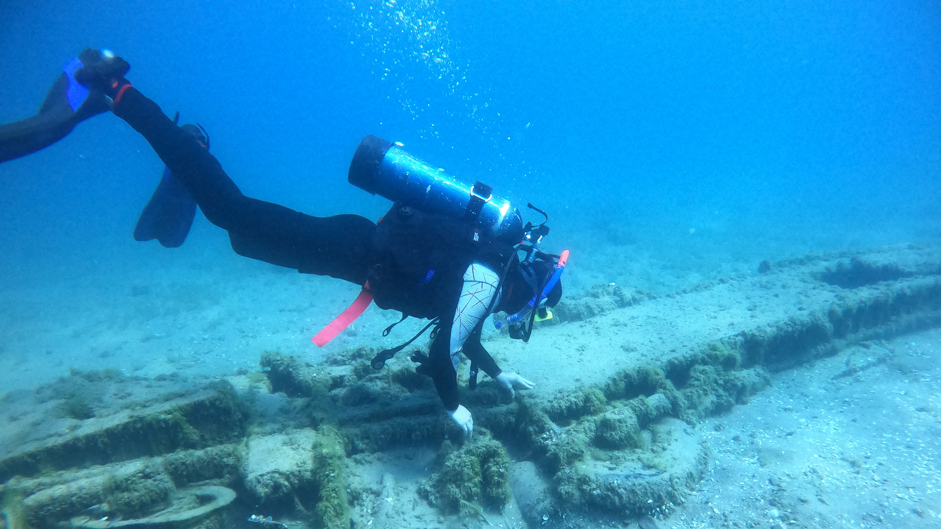
Shipwrecks are a wood and steel chronicle of the history of navigation, trade, and travel on the lakes. An estimated 6,000 vessels have been lost on the Great Lakes with approximately 1,500 of these ships located in Michigan waters. Explore shipwreck stories and locate nearby wrecks with this stunning storymap.
Some of the most interesting archeological resources in Isle Royale National Park are hidden beneath the frigid waters of Lake Superior. The island, about 50 miles north of Michigan’s Upper Peninsula, is close to shipping lanes from Duluth and Thunder Bay, Ontario. Isle Royale’s harbors were potential refuge during storms, but primitive navigation technology also made them treacherous. At least 10 wrecks of large ships, dating from 1870s to the 1950s, lie within the boundaries of the park. Explore these wrecks in storymaps and underwater photography.
Located in northwestern Lake Huron near Alpena, Thunder Bay is adjacent to one of the most treacherous stretches of water within the Great Lakes system. Unpredictable weather, murky fog banks, sudden gales, and rocky shoals earned the area the name "Shipwreck Alley." Today, the 4300-square-mile Thunder Bay National Marine Sanctuary protects one of America's best-preserved and nationally-significant collections of shipwrecks. Learn more about how to visit and appreciate these wrecks, including a 360-degree shipwreck video tour.
Since its establishment in 1980, Michigan's underwater preserve system has grown to occupy more than 2300 square miles of Great Lakes bottomland in twelve distinct underwater preserves. They protect some of the region's most sensitive and historic underwater resources.
Video: Learn about a unique archaeological study seeking evidence of early caribou hunters on the lands now inundated by Lake Huron.
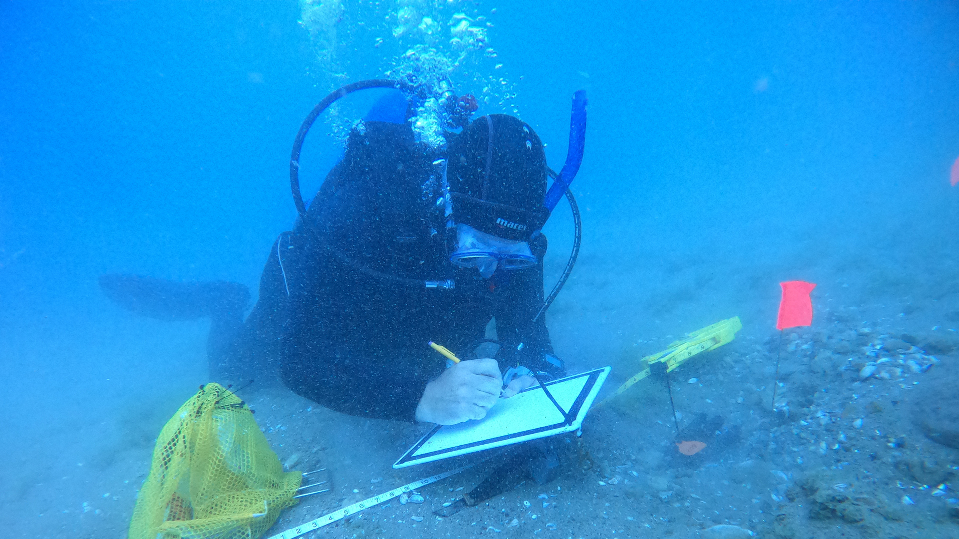
The Nautical Archaeology Society International Training Program is hosted by Northwestern Michigan College and is open to anyone who is interested in learning more about maritime and underwater archaeology.
A variety of state agencies partner in the stewardship of Michigan's submerged heritage. Learn more about this joint effort and who is responsible for what!
Fun for Young Archaeologists!

MSU Apparitions & Archaeology: A Virtual Haunted Campus Tour
A virtual “Choose Your Own Adventure”-style Apparitions & Archaeology Haunted Campus Tour that combines a tour of the sites we typically present at with in depth discussions of MSU’s historic campus, the people who helped to shape the school, and the results from some of CAP’s favorite archaeological investigations. The virtual tour is free and kid-friendly!
Take your love of archaeology digital
Share your enthusiasm for Michigan's archaeology with others by downloading our unique digital assets, including Zoom background images and printable kid's activity pages. Click the links below for your free image download!
Zoom background images (pre-sized to 1920x1080 pixels)
BONUS! Download and print our archaeology coloring book pages and word search!
Let's Take a Road Trip!
Michigan's archaeological history is fascinating! Learn more about state history and archaeology at these institutions. Consult individual entity websites for the latest information on days and hours of operation.
This interactive map created by the Michigan DNR displays information related to Michigan's geology, natural features, and mining history. Within the map, users can view the distribution of sediments that were deposited and features left behind by the continental ice sheets that moved across Michigan during the last Ice Age, as well as sediments deposited by wind and water since the glaciers melted. These are shown in the layers titled Michigan Surficial Geology, Critical Dunes and Quaternary Geological Features. In addition, you can view the bedrock geologic formations that lie directly beneath the glacial sediments by turning on the Michigan Bedrock Geology layer.
You can also explore where copper, gold and iron were historically mined in Michigan. Native Americans mined copper in Michigan's Upper Peninsula for thousands of years. Native people used copper to fashion tools and ornaments and revered it as a source of power. Zoom in and out and turn on and off the different layers on the left column to explore Michigan's colorful geologic history! Learn more about this map and Michigan geology here.
Explore Careers in Archaeology
There are many pieces to the puzzle of archaeology! In this series, the Society for American Archaeology explores some of the diverse careers in the field.
Read MoreMore to Explore
Check out the interactive state geology map created especially for Archaeology Day by Peter Rose, Michigan Department of Natural Resources. The map explores more than just rock types and sand dunes. Find Michigan waterfalls, abandoned mines, and more!
Since 1990, the federal Native American Graves Protection and Repatriation Act (NAGPRA) law has provided for the repatriation and disposition of certain Native American human remains, funerary objects, sacred objects, and objects of cultural patrimony. Learn about NAGPRA at this links.
Support Michigan archaeology by respecting sites on public land, being good stewards of sites on your property, volunteering, and learning more!
State government archaeology programs are administered by four cooperating entities. Who do you contact with questions? Use this guide to determine which office can assist you with your questions or needs.
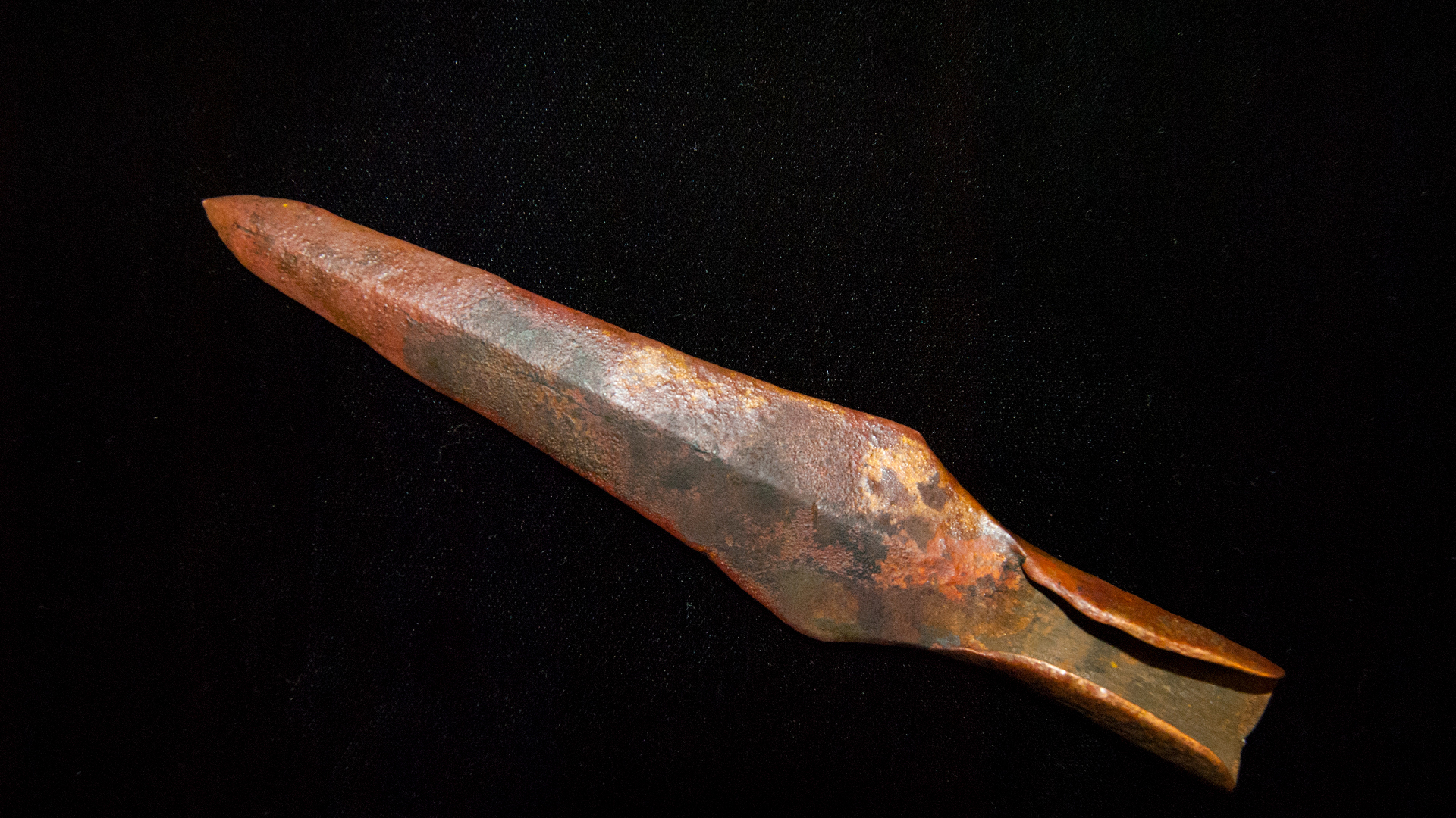
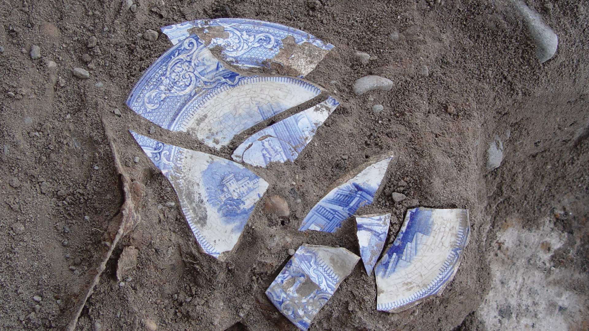
Once removed from their original locations, artifacts will lose their research value unless the removal is properly documented. Maintain good records for any artifacts you find, including a map of their original location and notes on how they were discovered.
SHPO archaeologists maintain the official record of archaeological sites in Michigan which includes more than 23,000 land and submerged sites and 1,500 shipwrecks, curate the state’s archaeological collections, accept artifact donations, nominate significant sites to the National Register of Historic Places, collaborate with Tribal and other descendent communities, and help landowners be successful site stewards.
Most importantly, we cannot protect or learn from sites that we do not know exist! If you think you have discovered an archaeological site, email your State Historic Preservation Office archaeologist so we can help identify what you've found: [email protected].
Is that part of a shipwreck? If you discover something along a Great Lakes shoreline, let us know by filing out the Great Lakes Coastline Survey Initiative Beach Wreckage Recording Form.
Artifacts are the property of the landowner (including the riparian landowner); you must have permission to remove artifacts from private land. Artifacts on federal or state land and bottomland (beneath the Great Lakes and where inland riparian rights apply) belong to all citizens, and it is illegal to disturb them. Leave them in place and report them to the appropriate land manager. Do not metal detect on public lands unless current regulations allow it.
Archaeological sites are nonrenewable. Once gone, they are gone forever. Treat every site with care and respect, and with their preservation for the good of future generations in mind.
With Thanks to our Partners
Archaeology Month is a success because of each entity's efforts to promote responsible archaeology in Michigan. We would like to thank and recognize each participating partner for Michigan Archaeology Month 2025 and those who make their research and collections publically accessible. The last thank you goes to you, the general public! Without your interest, participation and enthusiasm, archaeology month wouldn't be nearly as much fun. Thank you!

